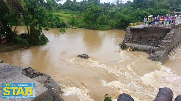
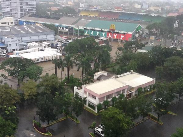
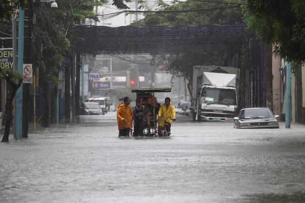
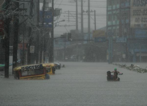
LIVE BLOG: Typhoon #MarioPH Update.
Ihahatid namin ang mga kaganapan sa bagyong Mario sa pamamagitan ng social media mga kuhang litrato ito ng netizens at media mula sa twitter. Follow our Live Blog for more updates sa bagyong #MarioPH


TROPICAL STORM “MARIO” HAS MAINTAINED ITS STRENGTH AND HAS MADE LANDFALL OVER THE NORTHERN TIP OF CAGAYAN.
Location of eye/center: At 10:00 AM today, the center of Tropical Storm “MARIO” was estimated based on radar and all available data at 64 km North Northeast of Tuguegarao City (17.8°N, 122.3°E).
Strength: Maximum sustained winds of 85 kph near the center and gustiness of up to 100 kph.
Movement: Forecast to move West Northwest at 22 kph.
Forecast Positions: By tomorrow morning it will be at 190 Northwest of Itbayat, Batanes and by Sunday morning, it will be at 680 km North of Itbayat, Batanes or outside the Philippine Area of Responsibility (PAR).
PUBLIC STORM WARNING SIGNALS:
PSWS # 2 (Winds of 61-100 kph is expected in at least 24 hrs) Cagayan including Calayan, Babuyan and Batanes Group of Islands, Isabela, Kalinga, Apayao, Mt. Province, Abra and Ilocos Norte, Batanes Group of Islands
PSWS #1 (Winds of 30-60 kph is expected in at least 36 hours) Aurora, Quirino, Nueva Vizcaya, Ifugao, Benguet, Ilocos Sur and La Union
•Residents in low lying and mountainous areas under signal #2 and #1 are alerted against possible flashfloods and landslides.
•Estimated rainfall amount is from 7 – 20 mm per hour (moderate - intense) within the 350 km diameter of the Tropical Storm.
•The combined effect of Southwest Monsoon and TS “MARIO” will bring moderate to heavy rains and thunderstorms in Metro Manila and the rest of Luzon which may trigger flashfloods and landslides.
•Fisherfolks and those with small seacrafts are advised not to venture out over the western seaboard of central Luzon, seaboards of southern Luzon and Visayas and eastern seaboard of Mindanao.
•The public and the disaster risk reduction and management council concerned are advised to take appropriate actions and watch for the next bulletin to be issued at 5 PM today.
Photo credits to the owner, please Refresh the page for the latest updates.
Bagyong #MarioPH Update:


![[#KTCA2014] Vote for your favorite Sweetest Loveteam for 2014.](https://blogger.googleusercontent.com/img/b/R29vZ2xl/AVvXsEiLTSHBe89iTJYFOn9OWaw3lhF32gaXoU01wYVC405HqoRVMSxI3kiszL80EFWIt-36F9HNXNNO0yvaeDAKp73rwxc-THMhoLaLK_rlwmlsVnnHAx28ls03_Kkf9lxMyNfB6Ivx9Pp6HZr5/s72-c/KakulayBlog.jpg)


No comments